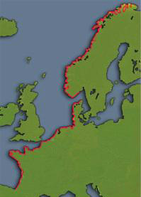
The Atlantikwall
|
|
Hook of Holland was the most important location of the Atlantic Wall in the Netherlands for the Germans because of its access to the port of Rotterdam. The Festung Hook of Holland, strategically located at the estuary of the Nieuwe Waterweg, ensured that this world port was sufficiently protected against a possible Allied invasion.
The Netherlands was home to two Festungen: Hook of Holland and IJmuiden. The Germans considered the Festung of Hook of Holland the most important stretch of the Atlantikwall in the Netherlands, because it could deny any invader access to the major port of Rotterdam.
The defense of the Festung Hoek van Holland can be divided into four parts;
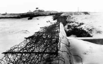
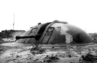
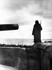
1. Coastal front The coastal front covers the coastline from the southernmost tip of Monster, through 's-Gravenzande, Hoek van Holland to the coast of the island of De Beer. The primary defense of the coastal front consisted of coastal batteries. The coastal batteries in Hoek van Holland had a firing range that varied from 8 to 43 kilometres. Theoretically, therefore, it was possible to hit targets in the vicinity of Noordwijk. Sea targets (and in some cases even land targets) could be fired at with the coastal batteries. The nearby anti-aircraft batteries had the task of defending the airspace of the Festung Hoek van Holland. In addition to the coastal and anti-aircraft batteries, there were also several Widerstandsnester along the coast from which the entire beach could be covered with artillery and machine gun fire, among other things. In addition, as a passive defense at weak points, a high concrete wall (Panzermauer) was constructed to prevent enemy tanks from easily pushing inland. 2. Outer Land front The outer land front runs from the southernmost tip of Monster via Naaldwijk and the Orange Canal to the Nieuwe Waterweg. The east of the island of De Beer also fell under the outer land front. As the name implies, this line was aimed at an attack from the landward side. The passive defense at this line consisted of an anti-tank ditch (Wasserpanzergraben). Minefields had been laid in various places on both sides of this ditch. The ditch itself was defended with artillery and machine gun fire from several Widerstandsnester along the ditch. There were only a few places with an entrance to the Festung Hoek van Holland. These roads could be closed by special barriers that were connected to the anti-tank ditch via Höckerhindernissen (dragon's tooth barriers). 3. Inner Land Front The inner land front ran from the coast between Hoek van Holland and 's-Gravenzande, via the Nieuwlandse Duin, east of the Haakweg to the Nieuwe Waterweg. It goes without saying that there was only talk of an inner land front from the construction of the outer land front. Before this there was only 1 land front. This inner land front also consisted of an anti-tank ditch with minefields and obstacles at the access roads. In addition to the usual Widerstandsnester, the primary defense of the inner land front also had two gun batteries from the Artillery Division. 4. Other works In addition to the aforementioned lines, there were also other construction locations in the Festung Hoek van Holland; the headquarters of the Festungskommandant, the harbor area (Berghaven) and the village of Hoek van Holland, the village of 's-Gravenzande and a battalion headquarters. In addition, several positions had been built for, among other things, searchlights, light anti-aircraft defenses and various infantry positions. None of the buildings on island ‘De Beer’ remain today. After the war this extraordinary piece of the Atlantikwall was demolished to allow for expansion of the port of Rotterdam. On the northern side of the estuary many buildings have been preserved. |